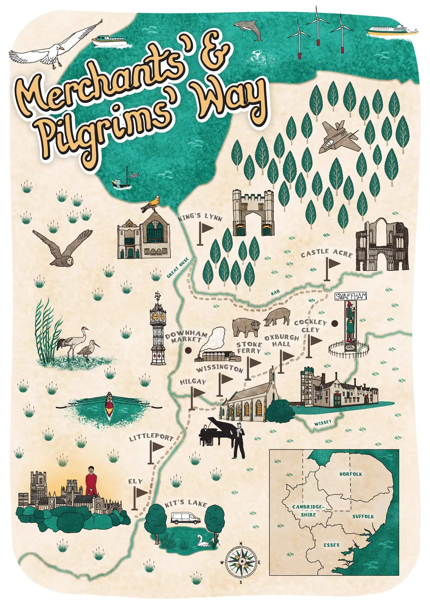
Project Background
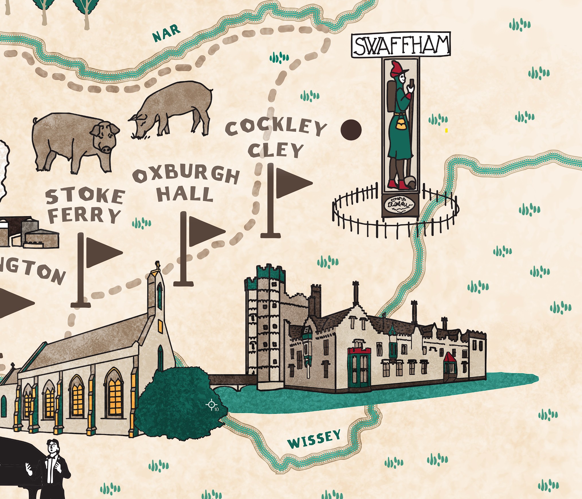
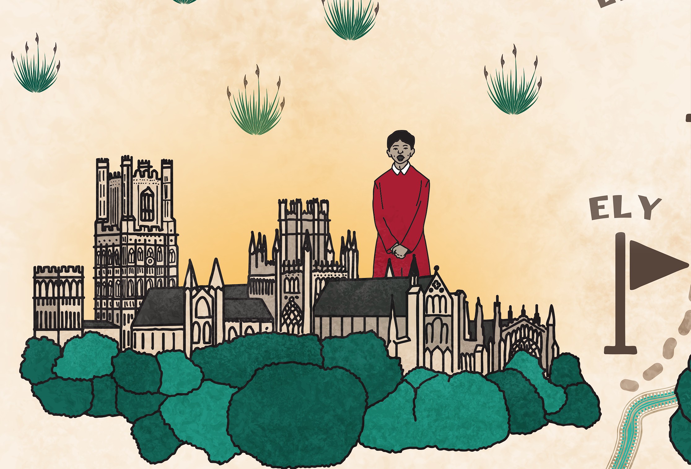
This illustrated walk map was created to guide walkers along the historic Merchants’ & Pilgrims’ Way, from Ely to King’s Lynn. The intention was to produce a map that is both practical and visually appealing, blending clear wayfinding with hand-drawn detail. Key locations along the route – Ely, Littleport, Hilgay, Stoke Ferry, Oxburgh Hall, and Castle Acre – are shown with stylised landmarks and local architecture, making the map a helpful companion while celebrating the character of the region.
The design seeks a balance between clarity and creativity, with rivers, lakes, and woodlands depicted in a cohesive, painterly style. Local wildlife, such as birds, pigs, and swans, is included to bring the landscape to life and enhance the sense of immersion for walkers. Boats, wind turbines, and other regional features add context and a subtle narrative to the map.
Typography has been carefully integrated so that place names, paths, and points of interest remain legible without interrupting the visual flow. Flags mark significant stops along the route, while illustrated bridges, churches, and historic buildings highlight cultural landmarks. An inset map provides geographical context, showing the trail across Norfolk, Suffolk, Essex, and Cambridgeshire.
This illustrated walk map offers a practical yet engaging way for walkers to explore the trail. Combining hand-drawn illustration with thoughtful design, it conveys both route information and the region’s heritage, making it a useful resource for locals and visitors alike.
Client
Private individual
Themes
Sector
Service
SHARE PROJECT