


Project details




About the project
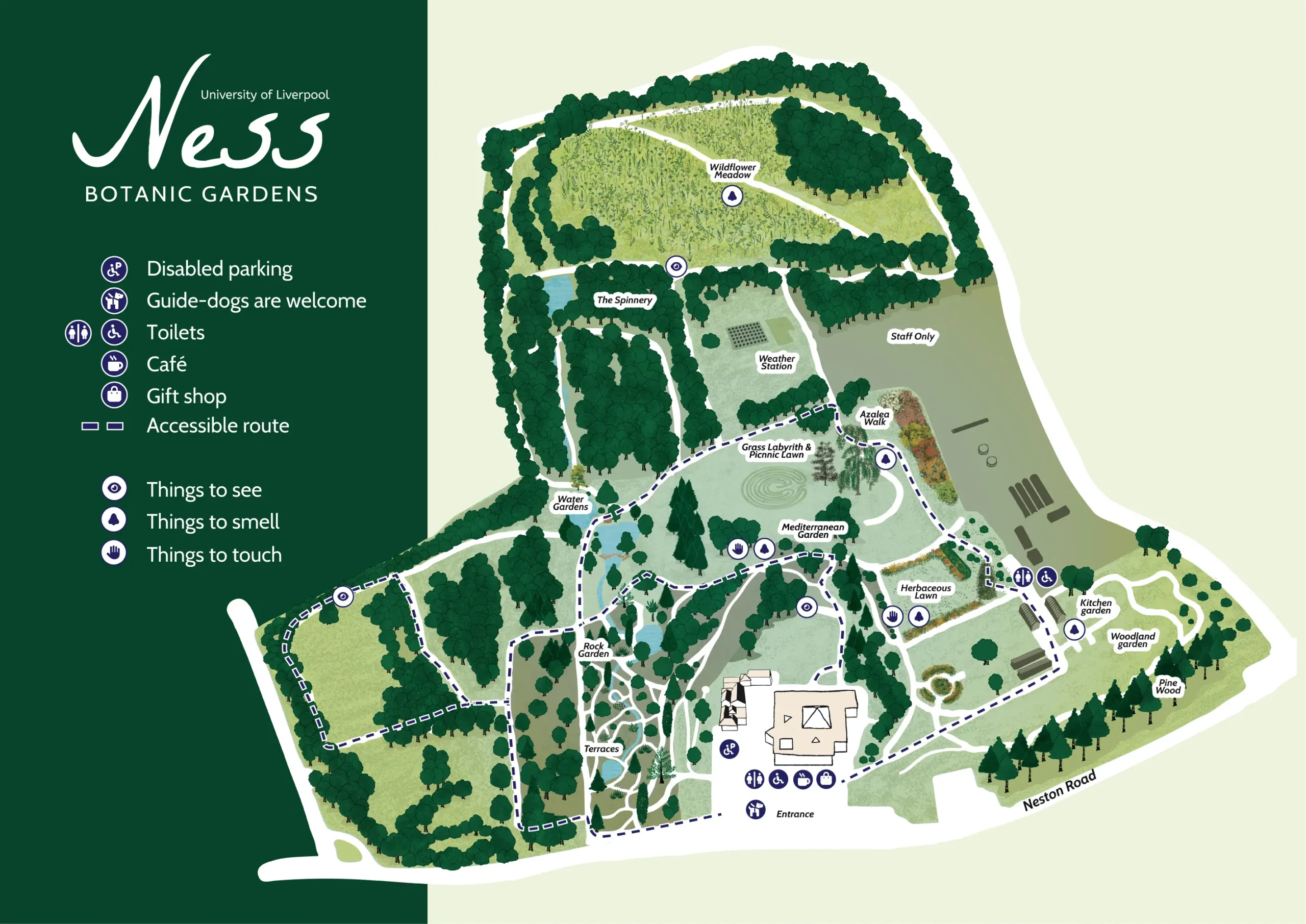
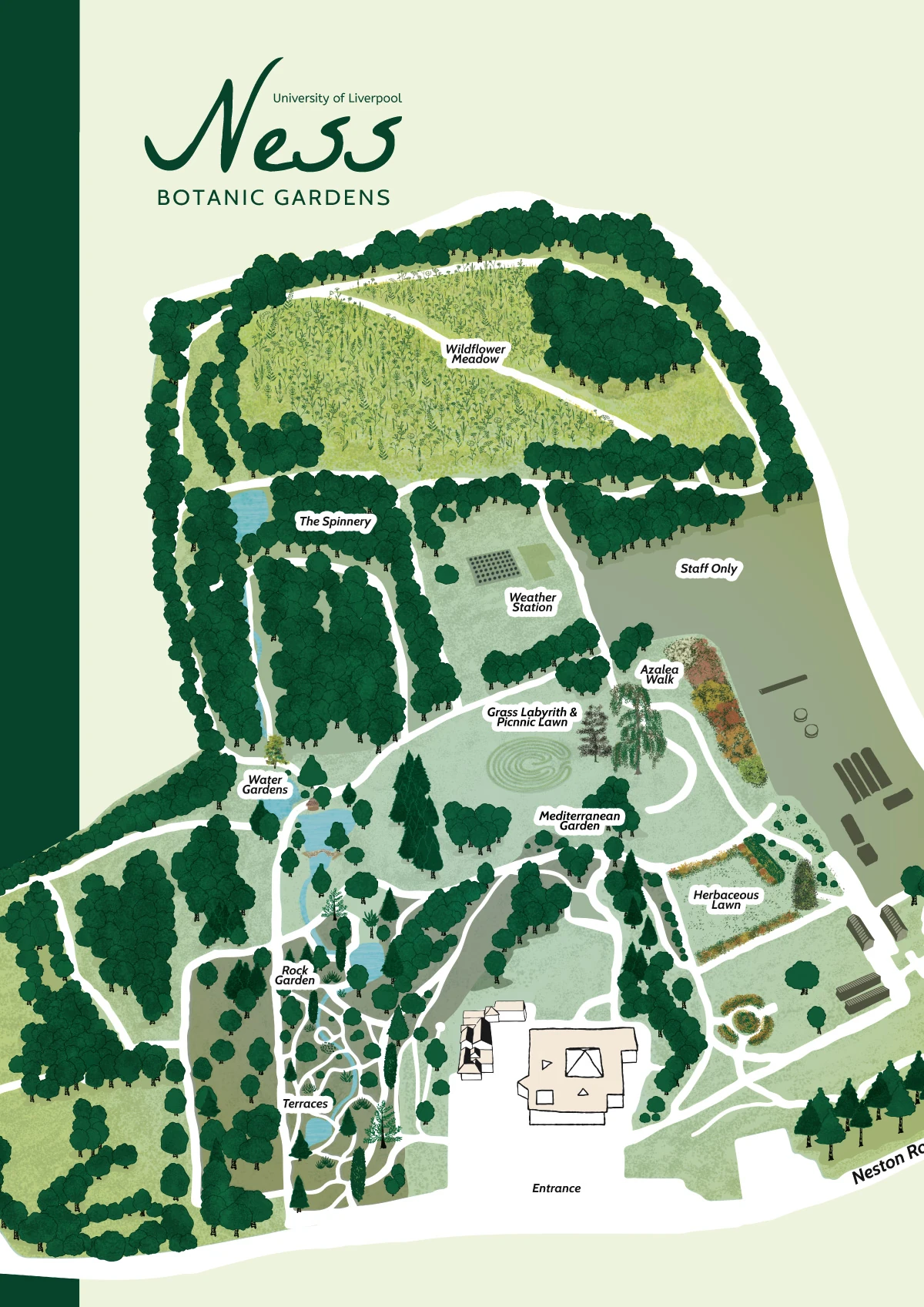
A map of Ness Botanic Gardens showing the garden’s different areas, such as meadows, azalea walks and parkland.
Alongside the usual visitor information, the key marks an accessible route and points out things to see, things to smell and things to touch, so the map helps people plan a visit around their senses as well as their route.

Planning an illustrated map?
I draw maps for heritage sites, museums, universities and nature reserves, to help people find their way and get a feel for the place.