
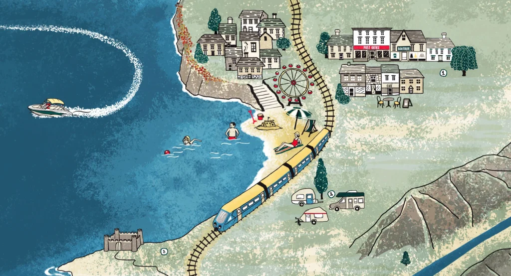
Commissioning a freelance map illustrator
What to expect when commissioning an illustrated map, from the first discussion and initial sketches to the finished artwork. Some practical advice on preparing a brief and deciding how much detail you need.
Introduction
Commissioning an illustrated map involves a few more considerations than commissioning a single illustration. As well as deciding how the map should look, there’s the question of what it needs to communicate, how accurately it needs to represent a place and how people will use it.
If you haven’t commissioned an illustrated map before, it can be difficult to know where to start. What information should you provide? How much detail do you need? And what affects the time and cost involved?
Here’s an outline of how I approach a map project and some things worth thinking about before you get started.
What do you need the map to do?
The first conversation is about the purpose of the map. Is it intended to help visitors find their way around a site? Introduce people to a place or its history? Show a collection of locations across a wider area? Or provide an engaging visual resource for an educational project?
It’s useful to think about:
- Audience: who will use the map and what do they need from it?
- Content: which buildings, landmarks, routes, stories or other features must be included?
- Format: will it be printed, used online or both?
- Size: where will people encounter it and how much space is available?
- Accuracy: does the layout need to correspond closely to the real geography or is there room for a more interpretive approach?
- Usage: will it be used for visitor information, promotion, education or commercial purposes?
You don’t need to have every detail worked out before getting in touch. But having a sense of the purpose and audience gives us somewhere to begin.
The process of making an illustrated map
Every project is different, but this is how a typical map commission develops.
Initial discussion
We talk through the brief, the information you want to include, the intended audience and how the map will be used. We also discuss the visual direction and any existing brand guidelines or other requirements.
Research
I gather the information and references needed to make the map. This might involve looking at plans, aerial photographs, archival material or existing maps, as well as visiting the site where possible.
Sketching the layout
I start with a rough pencil drawing to establish the composition and position of the main features. At this stage, the priority is getting the content and layout right: making sure the important locations are included and that the map works as a whole.
We review the sketch together and make any necessary changes before moving on to the detailed illustration.
Creating the illustrations
Once the layout is agreed, I develop the individual elements. These might include buildings, landmarks, trees, wildlife, people, lettering and smaller details that help give the map its character.
Depending on the project, I may share a more developed drawing for feedback before adding colour.
Finishing and delivery
I apply the agreed colour palette and refine the details. The finished artwork is then supplied in the agreed formats, ready for print or digital use.
How much detail and accuracy do you need?
This is one of the most important decisions to make early on. The level of detail can have a considerable effect on the time involved and the final cost.
Some maps need to be geographically accurate, with buildings, paths and boundaries closely matching the real site. My map of Kelmscott Manor, for example, includes detailed 3D buildings and a layout that closely reflects the grounds.
Other maps have more freedom. A series I created for Scottish Field magazine, showing film locations, used accurate place names but took a more illustrative approach to the geography. The emphasis was on creating a sense of adventure and encouraging readers to explore the locations.
Neither approach is inherently better. It depends on what the map needs to do and how people will use it.
The same applies to the amount of detail. A map doesn’t need to show everything. Sometimes a simpler illustration is more effective, particularly when the budget or available space is limited.
What affects the cost and timescale?
There isn’t a standard price for an illustrated map. The scope can vary considerably, from a relatively simple location map to a detailed site illustration with numerous buildings, characters and points of interest.
The main factors are:
- the size and complexity of the area being shown
- the number of features and illustrations to include
- the level of detail and geographical accuracy required
- whether buildings need to be shown in 2D or 3D
- the amount of research involved
- the intended use and licensing requirements
- the number of people involved in reviewing and approving the work
The feedback process can also affect the timescale. Having one person coordinate comments and decisions is usually much more straightforward than receiving separate feedback from several people.
It’s worth discussing your budget and deadline at the outset. There is often scope to adjust the level of detail to suit the resources available without losing what makes the map useful.
An example: an illustrated map of the Welsh coastline
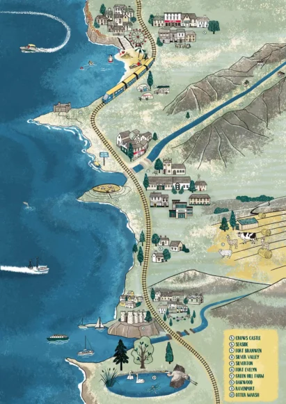
One commission involved creating an imaginary map of the Welsh coastline for an educational heritage project aimed at primary-school children.
The brief was to bring together a range of specific locations in a fictional landscape. After discussing the requirements and gathering references, I developed sketches for approval before creating the final illustration, with detailed features and hand-lettered labels.
The finished map became an online educational resource, helping children understand how life had changed since the Iron Age.
Getting started
You don’t need a fully developed brief to approach an illustrator. A description of the project, an idea of who the map is for and some initial thoughts about what it needs to show are usually enough to start a conversation.
If you’re still working out the content, budget or intended use, it’s helpful to say so. These things can be discussed as the project develops.

Planning an illustrated map?
I draw maps for heritage sites, museums, universities and nature reserves, to help people find their way and get a feel for the place.